Data types in GIS

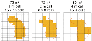
What are the difference types of Data used in GIS? There are mainly two types of Data, Spatial data(which is Non-tabular) and Non-spatial Data(Which is Tabular). *Spatial Data: Spatial data is simply related to the geographic information about the earth and its features. A pair of latitude and longitude coordinates defines a specific location on earth's surface. Spatial data are mainly two types according to the storing technique,raster data and vector data. Raster data are consist of grid cells which is identified by row and column. The whole geographic area is divided into groups of individual cells, which represent an image. Satellite images, photographs, scanned maps or images, etc.are examples of a raster type data. Vector data are consist of mainly points, polylines, and polygons.Trees , houses, etc.are represented by points. Roads, rivers, streamline, etc.are represented by polylines. Village boundary and towns are represented by polygons...


